- Best Car Rental in Iceland")


This is a visual reference to Iceland’s road signs, grouped by type so you can recognize them instantly while driving. It’s for anyone planning to rent a car in Iceland who wants to know exactly what each sign means, without guessing or slowing everyone else down.
Warning Signs
Warning signs in Iceland alert drivers to hazards, road conditions, or changes ahead. They are triangular with a red border and require immediate attention.
Road Alignment and Junctions
 Dangerous curve to the rightSharp right-hand curve ahead. Reduce speed before entering.
 Dangerous curve to the leftSharp left-hand curve ahead. Slow down and stay in your lane.
 Dangerous curve first to the rightSeries of curves ahead, starting with a right-hand bend.
 Dangerous curve first to the leftSeries of curves ahead, starting with a left-hand bend.
 Dangerous intersectionIntersection ahead where extra caution is required.
 Give wayYou must yield to traffic on the main road ahead.
 Intersection from side roadsTraffic may enter from side roads ahead.
 Intersection from the rightTraffic may enter from the right-hand side.
 Intersection from the leftTraffic may enter from the left-hand side.
 Offset road junction right–left, with priorityOffset junction ahead. Priority rules apply.
 Offset road junction left–right, with priorityOffset junction ahead. Follow posted priority rules.
 Roundabout aheadRoundabout approaching. Yield to traffic already inside.
Pedestrians, Cyclists, and Animals
 School zoneChildren are likely to be present. Reduce speed immediately.
 PedestriansPedestrians may be on or near the roadway.
 Zebra crossingMarked pedestrian crossing ahead. Pedestrians have priority.
 EquestrianHorse riders may be present on the road.
 Watch for horsesHorses may cross or travel along the road.
 Watch for cattleFarm animals may cross the road unexpectedly.
 Watch for sheepSheep roam freely and may enter the road without warning.
 Watch for reindeerReindeer crossings, mainly in East Iceland.
 Bike crossingCyclists may cross the road ahead.
Road Width and Traffic Flow
 Road narrows on both sidesRoad width decreases from both edges.
 Road narrows on right-hand sideRoad narrows from the right.
 Road narrows on left-hand sideRoad narrows from the left.
 Two-way trafficTraffic flows in both directions ahead.
Road Works and Infrastructure
 Workers aheadRoad works in progress. Expect delays or lane changes.
 Traffic lightsTraffic signals ahead.
 Tunnel aheadTunnel approaching. Headlights must be on.
 Road gradingRoad surface may be uneven due to grading work.
Gradient and Surface Conditions
 Steep descentSteep downhill section ahead. Use lower gears.
 Steep ascentSteep uphill section ahead.
 Bumpy roadSeries of bumps ahead. Reduce speed.
 BumpSingle bump or hump ahead.
 Loose gravelGravel on the road surface. Reduced traction.
 Road slippery when wetRoad becomes slippery in wet conditions.
 Dangerous shoulderRoad shoulder is unsafe to drive on.
 Unstable shoulderShoulder may collapse under vehicle weight.
Natural Hazards and Environment
 Risk of rockfalls or avalancheFalling rocks or avalanches possible, especially in mountainous areas.
 Risk of strong crosswindsSudden strong winds may affect vehicle control.
 Risk of ice on roadIce may form even when the road looks clear.
 Low-flying aircraftAircraft may fly at low altitude near the road.
 Harbour ahead without barriersRoad ends at water with no protective barrier.
Prohibitory Signs
Prohibitory signs indicate actions or access that are not allowed. These Icelandic road signs are circular with a red border and are legally enforceable.
Entry and Access Restrictions
 Prohibited entry (from this direction)Entry from this direction is not allowed.
 Closed to all vehiclesAll vehicle traffic is prohibited beyond this point.
 All motor vehicles prohibited entryNo motor vehicles are allowed to enter.
 Cars prohibited entryPassenger cars may not enter.
 Motorbikes prohibited entryMotorcycles are not allowed.
 Mopeds prohibited entryMopeds are prohibited beyond this point.
 Bikes prohibited entryBicycles are not allowed.
 Trucks prohibited entryTrucks are not permitted.
 Buses prohibited entryBuses are not allowed to enter.
 Tractors prohibited entryAgricultural vehicles are prohibited.
 Snowmobiles prohibited entrySnowmobiles are not permitted.
 Equestrian prohibited entryHorse riders are not allowed.
 Pedestrians prohibited entryPedestrian access is forbidden.
Vehicle Size and Weight Limits
 Width limitVehicles wider than the stated limit are not allowed.
 Length limitVehicles longer than the stated limit are prohibited.
 Height limitVehicles exceeding the height limit may not pass.
 Total weight limitVehicles exceeding the total weight limit are prohibited.
 Total weight limit of combinationCombined vehicle and trailer weight is restricted.
 Axle weight limitAxle load may not exceed the stated limit.
Stopping and Parking Restrictions
 Parking prohibitedParking is not allowed at any time.
 Beginning of zone with parking restrictionsParking restrictions apply throughout the marked zone.
 End of zone with parking restrictionsParking restrictions end here.
 Stopping prohibitedStopping for any reason is not allowed.
Speed and Distance Restrictions
 Maximum speed limit (km/h)Vehicles must not exceed the posted speed.
 End of maximum speed limitThe posted speed limit ends.
 Beginning of zone with special speed limitA special speed limit applies within this zone.
 End of zone with special speed limitSpecial speed limit no longer applies.
 National speed limit applies (rural: 90 km/h)Default rural speed limit applies.
 Minimum space between motor vehiclesDrivers must maintain the stated minimum distance.
Priority and Traffic Control
 Mandatory stopA complete stop is required before proceeding.
 Stop for checkpointStop required for inspection or control point.
 Yield to oncoming trafficOncoming vehicles have priority.
Turning and Overtaking Restrictions
 Right turn prohibitedRight turns are not allowed.
 Left turn prohibitedLeft turns are not allowed.
 U-turn prohibitedU-turns are forbidden.
 Overtaking prohibitedPassing other vehicles is not allowed.
 Overtaking by trucks prohibitedTrucks may not overtake.
 End of prohibition on overtakingOvertaking is permitted again.
 End of prohibition on overtaking by trucksTruck overtaking restriction ends.
Hazardous Goods Restrictions
 Vehicles carrying dangerous goods prohibited entryVehicles transporting hazardous materials are not allowed.
 Transport of water-polluting substances prohibited entryVehicles carrying water-polluting substances are prohibited.
Mandatory Signs
Mandatory Icelandic road signs show actions that must be followed. They are circular with a blue background and white symbols. Ignoring them is a traffic violation.
Direction of Travel
 Go rightYou must turn right at the junction ahead.
 Go leftYou must turn left at the junction ahead.
 Go straightYou must continue straight ahead. Turning is not allowed.
 Turn rightRight turn is mandatory.
 Turn leftLeft turn is mandatory.
 U-turnYou must make a U-turn.
Combined Direction Options
 Turn right or straightYou may either turn right or continue straight.
 Turn left or straightYou may either turn left or continue straight.
 Turn left or rightYou must turn either left or right. Going straight is not allowed.
Passing Instructions
 Keep rightYou must pass to the right of the obstacle or traffic island.
 Keep leftYou must pass to the left of the obstacle or traffic island.
 Pass either on sideYou may pass on either the left or right side.
Traffic Flow
 RoundaboutTraffic must circulate in the direction shown.
Dedicated Paths and Lanes
 Bikes onlyPath or lane reserved exclusively for bicycles.
 Pedestrian pathPath reserved for pedestrians only.
 Bikes and pedestrians onlyShared path for cyclists and pedestrians.
 Separate lanes for pedestrians and bikesPedestrians and cyclists must use their designated lanes.
 Path for ridersPath reserved for horse riders.
Information Signs
Information signs provide guidance, services, zones, and traffic-related information. They are typically rectangular or square and do not impose restrictions by themselves.
Parking Information
 Parking zoneDesignated parking area.
 Covered parking zoneParking available in a covered facility.
 Reserved parking place for handicapped vehicleParking reserved for vehicles displaying a valid disabled permit.
 Reserved parking place for specific vehicle used by handicapped personParking reserved for a specific registered vehicle used by a disabled person.
 Parking zone for busesParking reserved for buses only.
 Parking zone for trucksParking reserved for trucks.
 Parking zone for carsParking reserved for passenger cars.
 Parking zone with charging station for electric carsParking area equipped with EV charging facilities.
 Parking zone for caravansParking designated for caravans or motorhomes.
 Parking zone for ambulancesParking reserved for ambulances.
 Parking zone for bikesParking reserved for bicycles.
 Parking zone for motorbikesParking reserved for motorcycles.
Pedestrians and Crossings
 Zebra crossing / CrosswalkMarked pedestrian crossing.
 Pedestrian underpass to the rightPedestrian underpass located to the right.
 Pedestrian underpass to the leftPedestrian underpass located to the left.
 Pedestrian overpass to the rightPedestrian bridge located to the right.
 Pedestrian overpass to the leftPedestrian bridge located to the left.
Priority and Traffic Flow
 Main road (priority)You are on a priority road.
 End of main road (priority)Priority road status ends.
 Priority over approaching trafficYou have priority over oncoming vehicles.
 Place for allowing oncoming traffic to passDesignated passing place for oncoming traffic.
 One-way trafficTraffic flows in one direction only.
 Dead endRoad does not continue through.
Public Transport
 Bus stopLocation where buses stop.
 Bus terminalCentral bus station or terminal.
Zones and Areas
 Urban areaUrban zone begins. Lower speed limits apply.
 End of urban areaUrban zone ends.
 Living street (pedestrian priority, 15 km/h)Pedestrians have priority. Maximum speed is 15 km/h.
 End of living streetLiving street zone ends.
 Entrance to areaEntry point to a defined area or zone.
 Exit from areaExit point from a defined area or zone.
Special Road Use & Facilities
 HandicappedFacilities or access intended for disabled persons.
 Zone for putting snow-chains on tyresDesignated area to fit snow chains.
 Toll roadRoad subject to toll payment.
Tunnels and Large Vehicles
 Turnaround space for large vehicles on right (tunnel)Turning space for large vehicles located on the right side of a tunnel.
 Turnaround space for large vehicles on left (tunnel)Turning space for large vehicles located on the left side of a tunnel.
Speed and Enforcement Information
 Maximum speedsDisplays applicable maximum speed limits.
 Traffic enforcement camerasSpeed or traffic enforcement cameras in operation.
Service Signs
Service signs indicate facilities, amenities, attractions, and services available nearby. They are informational and help drivers and travelers plan stops, services, and activities.
Emergency & Health Services
 First aid or hospitalFirst aid services or hospital available nearby.
 HospitalMedical hospital services available.
 Police stationPolice services available.
 PharmacyPharmacy or drugstore nearby.
 Emergency shelterEmergency shelter available in case of danger or severe weather.
 Emergency phoneDirect access to emergency services.
 Fire extinguisherFire-fighting equipment available.
Information and Communication
 InformationGeneral information services available.
 Information boothStaffed tourist or public information booth.
 Public telephonePublic telephone available.
 Radio station / FM frequencyLocal radio station or emergency broadcast frequency.
Sanitation and Waste
 Public lavatoryPublic toilet facilities available.
 OuthouseBasic toilet facility available.
 Waste tank dischargeFacility for emptying waste tanks.
 Rubbish binSmall rubbish disposal point.
 Rubbish containerLarger waste disposal container.
Towns, Areas & Places
 Town centerTown or city center nearby.
 Industrial placeIndustrial or commercial area.
Accommodation
 Vacation housesHoliday cottages or vacation homes available.
 Hotel or motelHotel or motel accommodation available.
 Hostel (sleeping bags only)Basic hostel accommodation; sleeping bags required.
 Youth hostelYouth hostel accommodation.
 Rental cabinCabin accommodation available.
 Refuge hutMountain or emergency refuge hut.
 CampsiteDesignated camping area.
 Caravan parkCamping area for caravans or motorhomes.
Food and Drink
 Buffet or confectioneryCafé, buffet, or confectionery available.
 RestaurantRestaurant nearby.
 Restaurant in private homeRestaurant operated in a private residence.
 Food kioskSmall food stand or kiosk.
 BakeryBakery available.
 Ice cream shopIce cream shop nearby.
Vehicle Services
 Petrol stationFuel station available.
 Repair or workshopVehicle repair services available.
 Tire repairTire repair services available.
 Car rentalCar rental services available.
Facilities and Comfort
 Cooking facilitiesPublic or shared cooking facilities available.
 ShowerShower facilities available.
 Hot tubHot tub or bathing facility available.
 Laundry facilitiesLaundry or washing facilities available.
 Meeting facilitiesConference or meeting rooms available.
 Internet accessPublic internet access available.
Sports and Recreation
 Swimming poolPublic swimming pool.
 Recreation centreSports or recreation center.
 Sports fieldOutdoor sports field.
 Golf courseGolf course available.
 Shooting rangeShooting or target practice range.
Hiking, Nature and Attractions
 Point of interestGeneral point of interest.
 Place of interest (indoors)Indoor attraction or site.
 Hiking trailMarked hiking trail.
 Picnic siteDesignated picnic area.
 ViewpointScenic viewpoint.
 Viewpoint with informationScenic viewpoint with informational displays.
Horses and Animal Activities
 Horse hireHorse rental available.
 Horse trackHorse riding track.
 Horse stablesStables or horse facilities.
 Horsecart rentalHorse-drawn cart rental.
Fishing and Water Activities
 FishingFishing area.
 Ocean fishingSea fishing available.
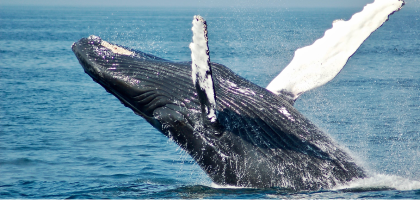
 Whale watchingWhale-watching activities available.
 Boat rentalBoat rental available.
 Water scooter rentalWater scooter rental available.
 Water skiingWater skiing activities available.
 River raftingRiver rafting activities.
Winter Sports
 Ski liftSki lift available.
 Ski lift with chairChairlift available.
 Cross-country ski areaCross-country skiing area.
 Snowcat tripsSnowcat tours available.
 Snowmobile rentalSnowmobile rental available.
Culture and Community
 ChurchChurch nearby.
 CemeteryCemetery nearby.
 Art galleryArt gallery available.
 LibraryLibrary available.
 Music venueConcert hall or music venue.
Shopping and Services
 ATMCash withdrawal available.
 BankBanking services available.
 Post officePostal services available.
 Tourist shopShop selling tourist goods.
 SupermarketGrocery supermarket.
 HandicraftsLocal handicrafts for sale.
 GreenhouseGreenhouse or agricultural attraction.
Animals and Nature
 AquariumAquarium or marine exhibit.
 Livestock animals parkFarm or livestock animal park.
 Dog hotelDog boarding facility.
 VeterinarianVeterinary services available.
Transport and Ports
 FerryFerry service available.
 Commercial harbourCommercial port or harbor.
 Fishing harbourFishing port or harbor.
 AirportAirport nearby.
 Aerodrome / airstripSmall airstrip or aerodrome.
Route and Direction Signs
Route and direction signs guide drivers to destinations, roads, lanes, and areas. In Iceland, signs inside the Capital Region use a blue-on-white design, while outside the Capital Region, they are generally black on yellow.
Route Guidance
 Route directionIndicates direction and route number for the destination.
 Route direction without number (winter route)Shows a designated winter route without a road number.
Turns and Exits
 Turn off (a) within the Capital RegionTurn-off sign used within the Capital Region.
 Turn off (b)Turn-off sign used outside the Capital Region.
 Turn off to place of interest, airport, harbour, public building, or other place of serviceTurn-off sign directing to services or points of interest.
Advance Direction and Destinations
 Notice of destination aheadAdvance notice of upcoming destination or junction.
 Destination ahead (a) with distances within the Capital RegionShows destinations and distances in the Capital Region.
 Destination ahead (b) with distances (rural)Shows destinations and distances in rural areas.
 Destination ahead per laneDisplays which destinations correspond to each lane.
 Destination ahead and map (a) within the Capital RegionAdvance destination sign with schematic map in the Capital Region.Destination ahead and map (b)Advance destination sign with schematic map outside the Capital Region.
 Destination ahead with route numbers (b)Shows destinations together with route numbers.
Lanes and Traffic Flow
 Exit lane (a) within the Capital RegionIndicates exit lane within the Capital Region.
 Exit lane (b)Indicates exit lane outside the Capital Region.
 Lane direction sign within the Capital RegionShows permitted directions for each lane.
Places and Names
 Place (turn off)Turn-off sign for a named place.
 Place name (e.g. a river)Sign indicating the name of a geographic feature.
 Street or road nameDisplays the name of a street or road.
 House numbersShows the range or location of house numbers.
Road Identification
 Road numberIdentifies the road number.
 Road number (approach)Advance notice of an upcoming road number.
 Unnumbered roadIndicates a road without an assigned number.
Administrative Boundaries
 Beginning of the municipalityMarks the start of a municipality.
 County or municipal boundary signIndicates a county or municipal boundary.
Destinations by Area Type
 Destination and distance (urban area, except Capital Region)Shows destinations and distances within urban areas outside the Capital Region.
 Destination and distance (rural area)Shows destinations and distances in rural areas.
Special and Local Markers
 Abandoned farmMarks the location of an abandoned farm.
Direction Signs
Direction signs provide lane guidance, lane usage rules, and advanced information about how traffic is organized ahead. They are especially important on multi-lane roads and near intersections.
Lane Reductions and Merges
 Reduction of available lanes (option 1)Indicates a reduction in the number of lanes ahead.
 Reduction of available lanes (option 2)Alternative layout showing lane reduction ahead.
 Approach lane merges rightLane merges into the right lane ahead.
Lane Use and Restrictions
 Use of lanes at an intersectionShows which lanes may be used for specific movements at the intersection.
 Lane markingsIllustrates lane layout and permitted movements.
 Lane directions and restriction (bus lane on right)Right-hand lane reserved for buses.
 Lane directions and recommendation (heavy vehicles on right)Heavy vehicles are recommended to use the right lane.
Road Layout Ahead
 Sign showing number of lanes on road to be enteredDisplays how many lanes are available on the upcoming road.
General Direction Signs
 Direction signsProvide directional guidance to destinations or routes ahead.
Temporary Signs
Temporary signs are used to indicate short-term changes to traffic conditions, usually due to roadworks or construction. They apply only for the duration shown or while conditions exist.
 Temporary traffic restriction notice (construction)Indicates temporary traffic restrictions due to construction or roadworks. Follow posted instructions and temporary speed limits.
Additional Signs
Additional Icelandic road signs are supplementary plates used together with other road signs. They specify location, extent, direction, duration, or conditions of the main sign.
Location and Position
 When the ‘road condition’ beginsIndicates the point where the stated road condition starts.
 On leftThe sign applies to the left side.
 On rightThe sign applies to the right side.
 On both sidesThe sign applies on both sides of the road.
Extent and Duration
 ExtendedIndicates the condition or restriction continues beyond the sign.
 Extended indication on the leftRestriction continues on the left side.
 Extended indication on the rightRestriction continues on the right side.
 Extent of prohibition areaShows how far a prohibition applies.Duration (timing) of prohibitionSpecifies the time period the restriction applies.
Parking Details
 Parking time limitMaximum allowed parking time.
 Parking places, parallel to roadParking spaces aligned parallel to the roadway.
 Parking places, perpendicular to roadParking spaces arranged perpendicular to the roadway.
 Parking places, angledAngled parking spaces.
 Handicapped parkingParking reserved for vehicles with a valid disabled permit.
 Tow zoneVehicles parked illegally may be towed.
Distance and Direction
 DistanceShows distance to where the sign or condition applies.
 Arrow rightIndicates direction to the right.
 Arrow leftIndicates direction to the left.
 Turn leftInstruction applies when turning left.
 Turn rightInstruction applies when turning right.
 Arrow directionGeneral directional indicator.
Priority and Traffic Flow
 Course of priority road at intersectionShows how the priority road continues through the intersection.
 Course of the priority roadIndicates the path of the priority road.
Safety Warnings
 Caution, blind peopleArea where visually impaired pedestrians may be present.
 Caution, deaf peopleArea where hearing-impaired pedestrians may be present.
Vehicle and Road Restrictions
 Weight limitMaximum permitted vehicle weight.
 New road surfaceFresh road surface ahead. Reduced traction possible.
Terrain and Road Difficulty (Iceland-Specific)
 Unbridged river crossingRiver crossing without a bridge.
 Slow roadDriving is difficult but possible for non-4×4 vehicles.
 Difficult road (4×4 required)4×4 vehicle required. Often marked with an F-road number.
 Mountain roadExtremely difficult terrain, even for 4×4 vehicles.
Visibility and Layout
 Blind hillLimited visibility over a hill crest.
 Area with higher accident riskRoad section with increased accident frequency.
 Single-lane paving (unpaved shoulders)Single paved lane with unpaved shoulders.
Narrow Sections and Structures
 One-lane bridgeBridge with one lane for both directions.
 One-lane bridge (with width)One-lane bridge with width information.
 One-lane tunnelTunnel restricted to one lane.
Traffic Lights
Traffic lights regulate vehicle movement at intersections. Iceland follows standard European light sequences, and compliance is strictly enforced.
 Red traffic lightsYou must stop completely before the stop line or intersection.
 Red–amber traffic lightsSignal is about to turn green. Remain stopped and prepare to move.
 Green traffic lightsYou may proceed if the intersection is clear.
 Amber traffic lightsPrepare to stop. Do not accelerate unless stopping would be unsafe.
Road Markings
Road markings communicate lane use, priority, and restrictions directly on the road surface. They are legally binding and often easier to see than roadside signs in poor weather.
Central Lines Separating Traffic in the Same Direction


Arrows Indicating Traffic Lanes

Painted Symbols and Text